-40%
History of Wood County Ohio
$ 7.02
- Description
- Size Guide
Description
WOOD COUNTY,
OHIO
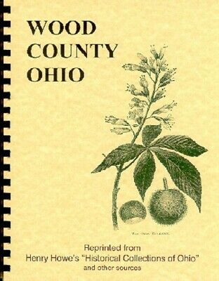
Early days in Wood County, OH, including the communities of Bowling Green, Perrysburg, North Baltimore, Grand Rapids, Freeport, Tontogamy, Bradner, Pemberville, Weston, Haskins, Bairdstown, Millbury, Jerry City and Rising Sun, are recalled through a mixture of colorful tales and factual data in this
NEW 33 Page Booklet,
reprinted from the 1892 Centennial edition of Henry Howe's
Historical Collections of Ohio
,
The Ohio Guide
(a WPA Writers Project), and other hard-to-find sources. The spiral-bound booklet is printed single-sided on quality paper with the fine print enlarged for easier
reading. A sheet of clear vinyl has been added to protect the front cover.
Illustrations include:
an 1846 sketch of Perrysburg from Maumee City, a photo of Bowling Green from 1887, and the Stafford Exchange Hotel.
Among the many and diverse subjects
in the booklet are: Early Military Expeditions; the Effect of Drainage; the First White Settlers; Importance of the War of 1812; Escaping the Pottawatomies; the Last of the Ottawas; Building of Fort Meigs; Langham's Desperate Enterprise; Seige of Fort Meigs; British View of Seige; Dudley's Defeat and Massacre; the second Siege of Ft. Meigs; Speculation in Would-Be Cities; Story of a Bell; Gas, Oil and Lime.
GENEALOGY BUFFS
will find a list of 1888 county officials and businesses. The Howe history covers the development of this area until about 1890, while excerpts from the WPA book, give a nostalgic glympse from a 1940 vantage point, including interesting historical notes, especially as they relate to sightseeing possibilities. There is also a brief article on early Wood County newspapers, a map showing Ohio's 88 counties, and a map depicting Ohio in territorial days.
Wouldn't this make a unique gift?
